|
|
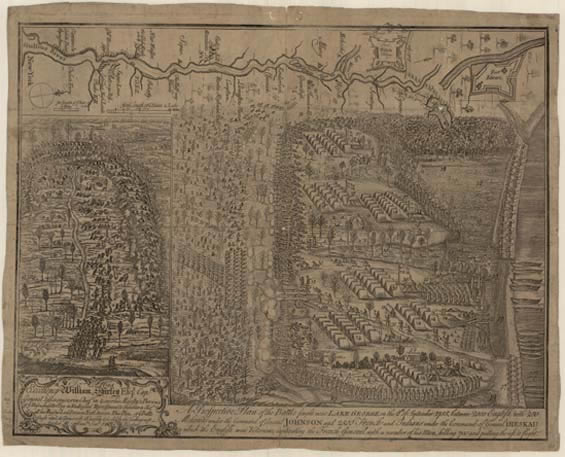
 Samuel Blodget, a civilian who provisioned military forces, was present at the battle of Lake George in 1755 and afterwards prepared this crude drawing from his observations. Although he had little education, Blodget possessed a shrewd marketing sense. He persuaded Thomas Johnston, one of Boston’s best engravers, to engrave the scene for publication, and Richard Draper, a Boston printer, edited the entrepreneur’s semi-literate account for a general audience. The map probably first appeared as an insert between the first two pages of the pamphlet, which Blodget was selling at his store in Boston by mid December—barely three months after the battle. View Blodget's explanatory notes |
|
|
 |
|
“A Prospective Plan of the Battle fought near Lake George on the 8th of September 1755, between 2000 English with 250 Mohawks under the Command of General Johnson and 2500 French and Indians under the Command of General Dieskau in which the English were Victorius, Captivating the French General with a Number of his Men, Killing 700 and Putting the Rest to Flight.” Drawing by Samuel
Blodget, engraving by Thomas Johnston. |
