|
|
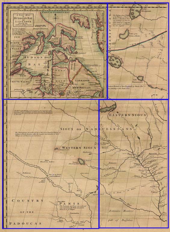
 This upper-left corner of John Mitchell’s map of North America, "A Map of the British and French Dominions in North America...," shows the limit of English interest as of the mid 18th century. Both England and France hoped to find a water route through the continent—a “Northwest Passage.” The inset of Hudson’s Bay includes the cartographer’s speculations on its probability. The Indian nations identified here, although known to both the French and English, were not in close contact with Europeans other than to trade, and their warriors played little part in the war. |
|
|
 |
|
[Map showing land of the Sioux and Padoucas.] One plate from “A Map of the British and French Dominions in North America with the Roads, Distances, Limits, and Extent of the Settlements Humbly Inscribed to the Right Honourable The Earl of Halifax and the Other Right Honourable The Lords Commissioners For Trade and Plantations by their Lordships Most Obliged and very Humble Servant Jn. Mitchell.” Title of inset map: Engraving by Thomas
Kitchin. |
