|
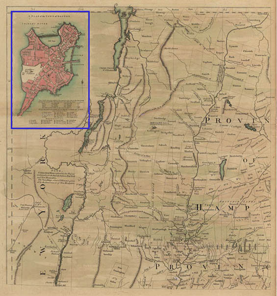
[Map
of New Hampshire and Hudson River, with inset map of Boston.] One plate
from “A Map of the Most Inhabited Part of New England, containing
the Provinces of Massachusetts Bay and New Hampshire, with the Colonies
of Conecticut [sic] and Rhode Island, Divided into Counties and
Townships; The Whole Composed from Actual Surveys and its Situation Adjusted
by Astronomical Observations.”
Title of inset map:
“A
Plan of the Town of Boston.”
London: Published by Thomas Jefferys, 1774.
Dimensions of entire sheet: 21 7/8 X 29 ¼ inches.
Dimensions of image: 19 3/8 X 20 3/8 inches.
Dimensions of
inset map: 5 5/8 X 8 5/8 inches.
Plate 28 from Atlas Des Colonies Angloises en Amerique (after 1777).
[Title of atlas taken from manuscript title page.]
Click here to view citations for all of the maps.
|