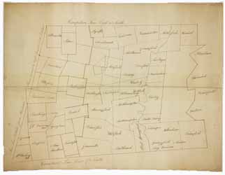
Map of western Massachusetts, circa 1785
Image 1 of 1
To order an image, navigate to the full
display and click "request this image"
on the blue toolbar.
This map of western Massachusetts shows cities and towns in present-day Berkshire, Franklin, Hampden, Hampshire, and Worcester counties, as well as the Connecticut River. There are large areas of Berkshire, Franklin, and Hampshire counties that are unnamed. The dotted lines roughly follow current county borderlines.

