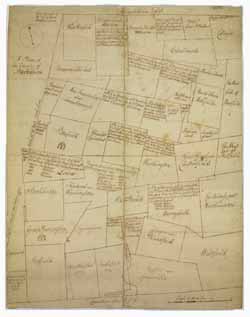
Manuscript plan of Berkshire County (Mass.), 1777
Image 1 of 1
To order an image, navigate to the full
display and click "request this image"
on the blue toolbar.
This plan of Berkshire County captures a much larger area than the county represents today. In 1777, Berkshire County extended from Westfield and Colrain in the east to Egremont and "West Hoosuck" (later Williamstown) in the west. This plan lists landowners by family name, acres owned, the date of purchase, and previous owner. The plan also details the acreage available in unnamed towns, areas identified as either 'unappropriated land' or 'province land.'

