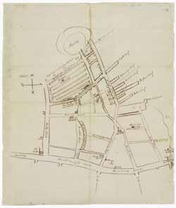
Manuscript map of Boston (Mass.), 20 September 1794
Image 1 of 1
To order an image, navigate to the full
display and click "request this image"
on the blue toolbar.
This manuscript map by Jeremy Belknap was enclosed in a letter he sent to Ebenezer Hazard on 20 September 1794 and shows the Tontine Crescent, churches and meetinghouses (including the Old South Meeting House, Trinity Church, and the Federal Street Church), wharves, and the locations of Belknap's various residences in Boston. The map also shows the location of the origin of a fire on 30 July 1794 (within the ropewalks located near Fort Hill) and a dotted line indicates the extent of the damage. The map's western boundary is present-day Washington Street.

