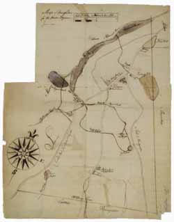
Manuscript map of Stoughton, June 1785
Image 1 of 1
To order an image, navigate to the full
display and click "request this image"
on the blue toolbar.
This map of Stoughton shows roads, meadows, waterways, mills, taverns and the meetinghouse in the town in 1785. The map was drawn by Nehemiah Bennett for Boston Magazine. The Neponset River, Pidgeon Swamp, and Ponkapoag Pond dominate the top area, which was drawn on a separate sheet of paper and affixed to the map.

