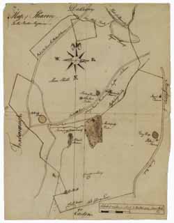
Manuscript map of Sharon, circa 1784
Image 1 of 1
To order an image, navigate to the full
display and click "request this image"
on the blue toolbar.
Nehemiah Bennett drew this map of Sharon for Boston Magazine. The map shows the locations of taverns, a meetinghouse, ponds, swamps, hills, meadows, brooks, town lines, and roads. The scale of the map is two inches to the mile. Bennett wrote the names of the towns bordering Sharon toward the edges of the map--Dedham to the north, Foxborough to the west, Easton to the south, and Stoughton to the east.

