Collections Online
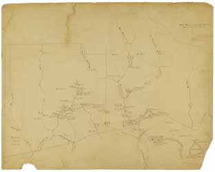
Manuscript map of old Bridgewater, Mass. before 1746
To order an image, navigate to the full
display and click "request this image"
on the blue toolbar.
Joshua E. Crane's map of old Bridgewater consists of two sections and contains details about locations of early highways, paths, burying places, and residents' houses before the census of 1746, as well as ponds, lakes, brooks, and rivers. One section shows the second precinct, incorporated 1 June 1716, and the other, the East Parish, incorporated on 14 December 1723. Along the bottom edge of the first section are notes about significant land purchases in 1649, 1672, and 1698 that gave shape to the town. In addition to these notes, historical town lines demarcate the growth of Bridgewater.
The two sections of the map do not fit perfectly together, but they do overlap along the precinct line. The East Parish map (2 of the sequence for this online display) is noticeably empty of detail at the bottom (the area below the precinct line). The same precinct line is marked at the top of the Second Precinct map (1 of the sequence for this online display).

