By Heather Rockwood, Communications Associate
Massachusetts is at the height of summer season, and one thing that many people who live here like to do is go to the beach! The state has 192 miles of coastline and ranks 10th in the country for coastline miles (Alaska with 6,640 coastline miles is in first place).
There are three beaches I’d like to focus on today—Carson Beach, L Street Beach, and M Street Beach in the South Boston neighborhood near Columbus Park and Andrew Square. The MHS has two photos of the beaches, available online. The images are from the Arthur Asahel Shurcliff collection of glass lantern slides and date to the 1920s. The first picture is an aerial view of the beaches, taken by Fairchild Aerial Surveys and capturing mostly Carson Beach with its curving shoreline and background of Columbus Park.
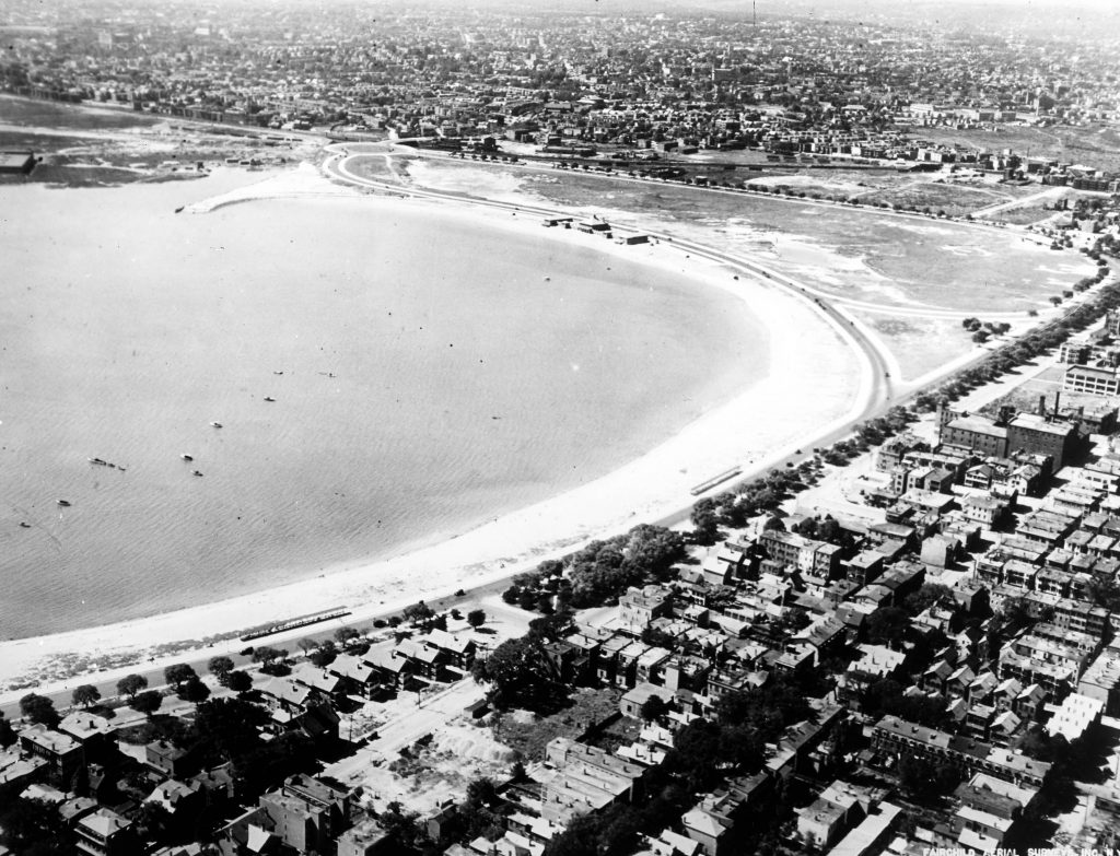
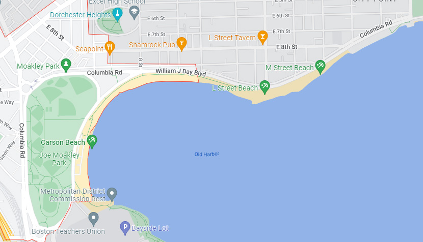
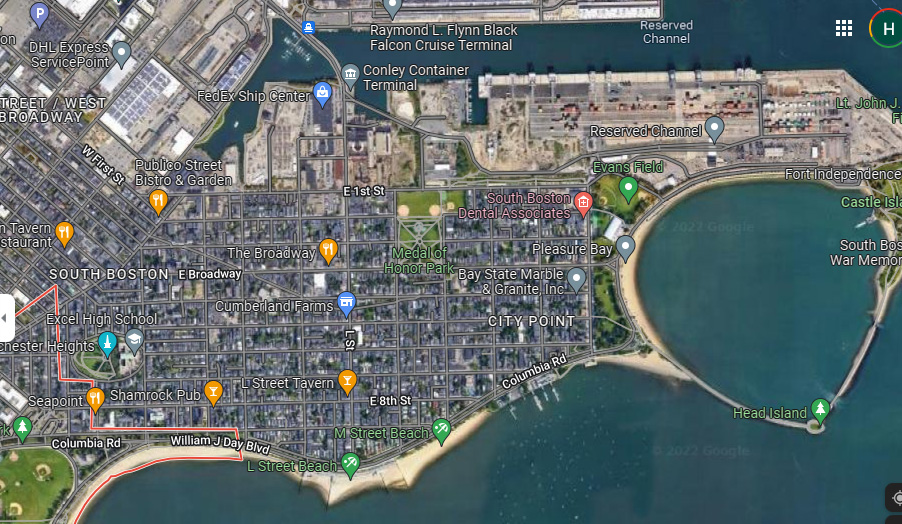
Compare this image to Google’s image of the beach below.
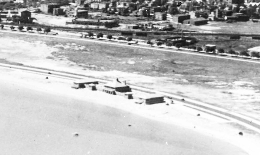
Of note in the Fairchild Aerial Surveys’ image are its aerial view—a new technology in the early twentieth century with the development of flight—and the building on the beach, shown in the close-up view below.
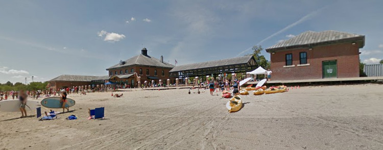
The Carson Beach Bathhouse was built in 1925 and used by the local community as a changing room and field house, but by the 1970s found less use and by the 1990s was in disrepair. During Massachusetts’s major beach renovation project in the 1990s, the bathhouse was rebuilt and moved from the sand dunes to be closer to the street. Below is a Google Map image of the bathhouse in 2022.
The second image, labeled Columbus Park Beach, was taken by an unidentified photographer. The most striking part of the image is the children in the foreground looking right at the camera. I’d like to point out some other details that might be missed at first glance.
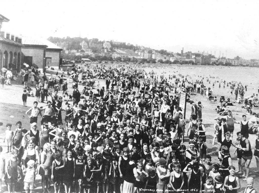
I particularly love photographs that give the viewer a sense of a how life was lived in the past, and here in the background, is a detail showing how life was just as industrial as we now believe ourselves to be: the smokestacks.
The smokestacks are most likely from an area of South Boston that continues to be industrial today. Take a look at the Google’s satellite image of the area below—the stretch from the FedEx Ship Center to Fort Independence is still an industrial area, and close by are the L Street and M Street Beaches at the bottom of the map.
The last thing I want to point out in this image is that most of the people are white and predominantly boys; however there is one person of color, right up front. Take a look at the detail below to see her.

Her back is turned to the photographer as she cares for the white boy in front of her. The scene suggests that the image was staged—what we can assume is a Black woman working as a nanny to care for this white child and the massing of children all together on a beach—a major feat if candid! The photographer didn’t mind that his image caught some of his subjects off guard.
Thank you for joining me to study these two photographs and a small part of the stories they can tell us. After reading this, be sure to go to a Massachusetts beach as soon as you can!

