By Laura Williams, Visitor Services Coordinator
As I look forward to future days when the doors of our institution are once again open to the public, it has been difficult not to miss walking through the beautiful Back Bay neighborhood on my usual commute. This neighborhood has been home to the MHS since March of 1899, though it hasn’t always been made up of the beautiful tree lined streets we see today!
There are so many interesting pieces from our collections regarding the development of the Back Bay neighborhood, beginning with the Boston & Roxbury Mill Corporation records from 1794-1912. When Back Bay was still just a bay of water, this company had previously used a dam on the bay to draw power for its mills. Unfortunately, this led to improper draining and a backup of wastewater that created a horrible smell. This was the way of it until 1856, when the Commonwealth of Massachusetts decided to fill in the Back Bay and to construct a new neighborhood on top of the wasteland. [1] These records serve as a valuable piece of history for the understanding of city planning and development in Boston during years of momentous change.
In addition, the MHS is home to photographic documentation of certain aspects of this project. Below I have highlighted some pieces from the Arthur Asahel Shurcliff collection of glass lantern slides which show many plans and views of the Back Bay neighborhood. Shurcliff worked in the planning and development of Metropolitan Boston beginning in 1905, and served as an active member of the Boston Parks Commission and the Boston Planning Board. Shurcliff’s success in landscaping architecture extended outside of Boston as well, in the planning of Colonial Williamsburg, Virginia, the Plymouth Rock Shrine at Plymouth, Massachusetts, and consulting for the development of Old Sturbridge Village, Massachusetts.These lantern slides were digitized at the MHS in 2018, and show a unique view of the developing community.
Enjoy a look back at the MHS’s neighborhood and see what differences stand out to you! Explore the full collection of lantern slides here.
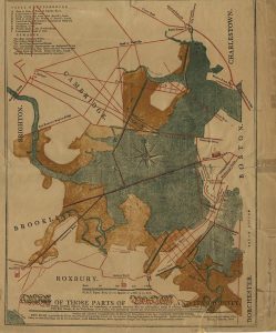
To begin, I have included a map by Benjamin Dearborn depicting previous proposed plans for the Back Bay area, circa 1814. Due to impending sewage and wastewater buildup as result of similar plans, the land would later be filled in.
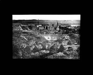
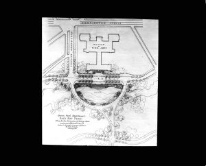
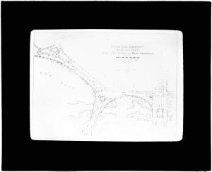
These plans show the Boston Park Department’s ideas for the Extension of Jersey Street c. 1912. Peep the MFA!
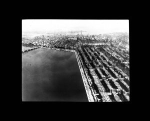
Aerial view of Back Bay c. 1920’s.
View of Back Bay c. 1920’s.
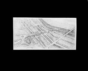
This image shows Shurcliff’s plans for widening roadways in Back Bay c. 1925.
[1] History. (2015, September 23). Back Bay Association. www.bostonbackbay.com/about-back-bay/history/

